When you think about the best Nordic countries to visit in the northern part of Europe, it is difficult not to remember Denmark. Nestled between the North Sea and the Baltic Sea, Denmark can be recognized for its landscape of fiords, beaches, and rolling plains. If you want to know more about this intriguing country, then read on and get your dose of the Geography of Denmark.
Where is Denmark located ?
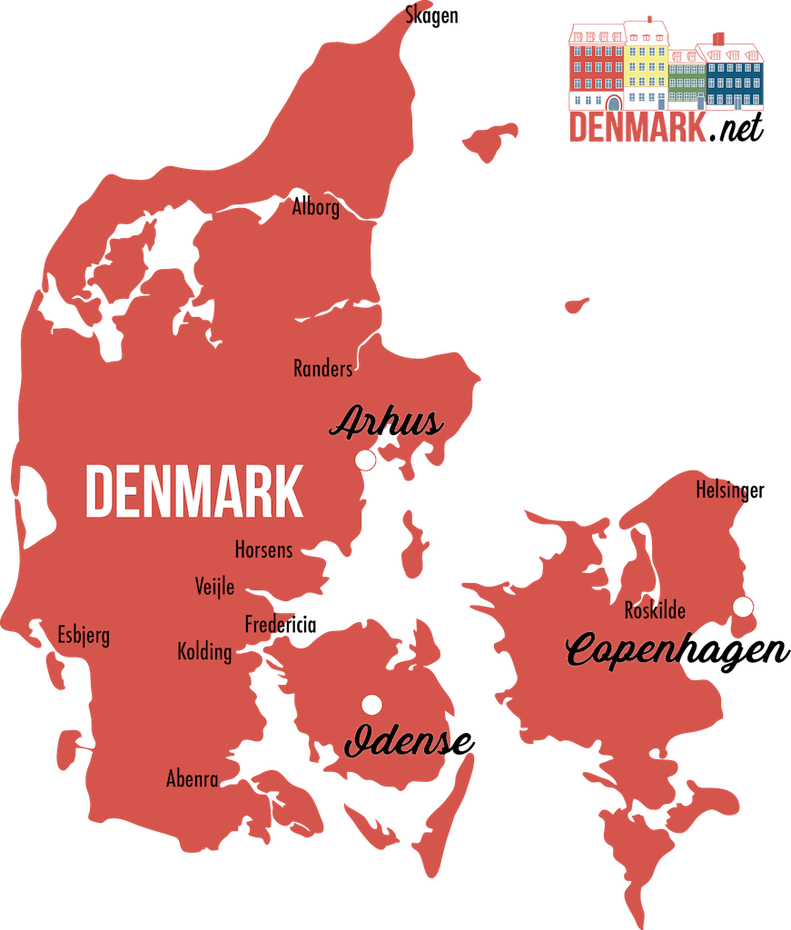
Denmark is a sovereign state located in Northern Europe. Here you can find where it is exactly on the map:

Geography Facts of Denmark
Denmark regions
Denmark is a combination of the Jutland Peninsula and it large archipelago of more than 440 islands. The largest areas are:
- Zealand
- Funen
- Jutland
- Vendsyssel-Thy
- Mon
- Bornholm
- Amager
- Falster
- Lolland
- Longland
- Tasinge
- Aero
- Als
- Romo
- Fano
- Mors
- Fur
- …
The coastline of Denmark is an impressive 7,300 kilometers, making the country ideal for harbors, fishing, as well as beaches for the tourism industry. On the south end of Denmark lies a 68 kilometer border which is shared with Germany. The largest peninsula is known as the Jutland Peninsula, which is divided in to regions as well. On the eastern portion of Denmark lies the Zealand region, also known as Sjaelland. The island of Bornholm is the eastern most in Denmark, and is found to the south of Sweden and to the North of Poland.
Denmark biggest cities
Copenhagen is the Capitale of Denmark. Then come Arhus and Odense as dynamic cities with great tourist activities.
A detailed map of Denmark
Geography of Denmark: Climate
The climate of Denmark is marked as temperate, where the summer season is generally cool and the winters fairly colder. However, in some portions of the country, there is ample sunshine, great for tourists who like to spend their days at the beach. The warmest months are generally in July and August, and the coldest ones in February and March.
Geography of Denmark and Land facts:
If you want a little more extra info on the land, here are some trivia tidbits:
Denmark most famous peaks
- The highest peak in Denmark is Yding Skovhøj, located in the municipality of Horsens in the Jutland Region. It stands 172 meters above sea level, and is popular as a tourist spot because of ancient burial mounds dating back as far as the Bronze Age.
- Mons Klint, or the White Cliffs of Mon in the Zealand Region is named such because of the limestone or chalk deposits which are abundant in the landmass. The cliff reaches up to 128 meters above sea level, and the land around it has become ideal for the growth of a rare orchid known as Orchis purpurea.
Denmarks lake and rivers
- In Denmark, the largest lake is Arreso, which is found in the Hovedstaden Region. It has a total area of 40 square kilometers, and many wildlife preserves have been established in this area.
- The River Guden, or Gudena, is the longest river in all of Denmark. It flows along the Jutland Peninsula and is over 175 kilometers long. Also, this river is home to many species of plants and animals. The most abundant fish in this river is salmon.

Other Geographic facts Denmark
- The lowest point in Denmark is the Lammefjord, which is nearly 7 meters below sea level. It is also said to be the lowest point in the European Union.
- The largest island of Denmark is Zealand, or Sjaelland, which is more than 7,000 square kilometers in land area. It is noted as the 95th largest island in the world. The second largest in the country is Vendsyssel-Thy, and the third is Funen or Fyn.
Denmark is a nice country for one to visit.it is good for tourism
I still don’t know if Denmark is a country or a state. This didn’t help
Hi! Denmark is a sovereign state in Northern Europe